Monday, September 5, 2016

Paddling at Etelä-Konnevesi National Park

The first weekend of September was booked for a short paddling trip at Etelä-Konnevesi National Park.

At Pieni Navettasaari -island

Started paddling on Saturday morning from small harbor, which were next to National Park. Etelä-Konnevesi is one of the newest National Parks in Finland. There are lots of small rocky islands in a tiny area of Konnevesi - lake.

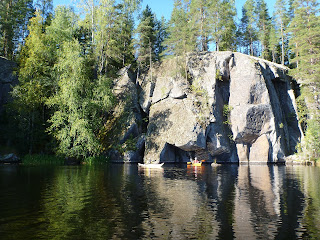
Under the cliff

It was beautiful day with sunshine when we paddled slowly and silently in the maze of the islands. We spotted other paddlers as well during the day, they were coming from Kuopio. They stayed and had reserved sauna, but we continued our way to small island where we stayed overnight.

The paddling route of Saturday can be seen here.

On Saturday sun was shining

On Sunday we headed quite straight back to harbor and our cars. The day was clouder and colder than Saturday.

The paddling route of Sunday can be seen here.

Monday, August 29, 2016

Vuoksennauhamelonta-paddling, day 9 Puumala - Lappeenranta (62 km)

Sunday 28.8.

After strong Rauli - storm on Saturday paddling continued to Lappeenranta.

The whole Saturday was spent in Puumala listening the howling wind, which was pretty strong. It must have been at least 15 m/s in the evening. We were staying at Puumala camping and visited town on afternoon.

Tractor gathering at Puumala

There were dozens of old tractors gathered on a local square and after awhile they drove through the town on this event, which is organized every year.

The storm passed during the night and wind was moderate 6-7 m/s from north-west in the morning. This direction of the wind was optimal for us, because we were paddling to south-east or south whole day. It was much colder than yesterday due to change of direction of the wind.

At Puumala camping

The first leg was roughly 30 km to Kutvele,where we planned to have a lunch break. After Kutvele - channel we landed on a beach, which was on a shelter from the wind. Sun was shining practically throughout the day.

Lunch break at Kutvele

When crossing Suur-Saimaa after Kutvele,waves were moderate, but still rather easy to paddle. The last 15 km felt endless, but finally we reached Lappeenranta and the beach of Myllysaari, which was the ending spot for Vuoksennauha-paddling.

After 10,5 hours paddling at 18:50 we had paddled 429 km from Nurmes to Lappeenranta.

The paddling route of the ninth day can be seen here.

Saturday, August 27, 2016

Vuoksennauhamelonta-paddling, day 8 Savonlinna - Puumala (69 km)

Friday 26.8.

The autumn storm has been forecasted to hit Finland on Saturday and wind is expected to increase up to 11 m/s. It seems that we can't paddle on Saturday at all.

Calm evening at Kietävälänvirta / Haapaselkä

Because we have reserved only three days for paddling and now it seems to decrease to two days we had to make new plans. We have still nearly 140 km to go.

We decided to plan a longer day today and try to reach Puumala. In the morning wind was blowing from west, but we managed to plan the route in such a way we got shelter from the islands on the way.

The first stretch was a long one, 33 km,  up to Telataipale - channel, where we had a lunch break. The wind was calming down and afternoon / evening was expected to have pleasant paddling with non-existent wind.

The ferry "Nestori" at Kietävälä

I was feeling powerful today and paddling was easy. It seemed possible to reach Puumala just at sunset and we landed on a beach just after sunset. However it was not allowed to camp on a beach and after a quick decision started paddling again towards Koskenselkä - camping place, a bit north from the beach. It was already dark and we paddled silently through the harbor towards north.

Close to Puumala

Landed on camping place just before 10 PM. The timing was just perfect, because wind started to increase immediately after our arrival.

Puumala - bridge after sunset

The paddling route of the eighth day can be seen here.

Vuoksennauhamelonta-paddling, day 7 Enonkoski - Savonlinna (48 km)

Thursday 25.8

In the morning I felt on my muscles the stress of the previous 60 km paddling. The weather forecast was not too good. Rainfall and strong headwind all the day. The wind was increasing in the afternoon and we decided to start early.

However it was already at 8 AM when we managed to start the paddling. The day was hard for me. The first part until Haponlahden kanava - channel went pretty OK, but after the channel the headwind from south striked us.

Rainy day at Haukivesi

It was raining and we fought towards south to cross Haukivesi and Pieni Haukivesi water areas. The plan was to paddle directly and as fast as possible to Savonlinna, before wind increases. However we didn't succeed and due to not having lunch break I was totally exhausted, wet and cold when we finally arrived to Haapavesi and Savonlinna.

Selfie

As a miserable ending for the day the camping place - Vuohimäki - had closed already few days earlier. We got a permission to land and pitch our tent though, but there were not any facilities or services. This was not my lucky day...

On the evening went to downtown and had supper on a local restaurant. This night I was sleeping like a baby.

The paddling route of the seventh day can be seen here.

Vuoksennauhamelonta-paddling, day 6 Pyhäselkä - Enonkoski (61 km)

Wednesday 24.8

Because the previous day was a short one, only half a day, we had to paddle one longer day i.e. 60 km distance. The wind was quite strong 6-7 m/s but it was blowing mostly from north-west or north. Therefore we didn't had headwind, but still it was quite demanding to paddle on large open water areas, where waves were higher.

At Savonranta

We had a long first stretch to Savonranta guest harbor, where we had a long and rewarding break at local cafeteria / restaurant. The first pizza during this paddling tasted heavenly.

At Jouhivuori

We managed to find a small spot - Jouhivuori - for staying overnight. There were even "laavu" - a lean-to shelter, but we pitched the tent because of the mosquito. The temperature was only 11-13 degrees whole day due to wind from north. The signs of autumn are on the air...

The paddling route of the sixth day can be seen here.

Vuoksennauhamelonta-paddling, day 5 Joensuu - Pyhäselkä (20 km)

After two weeks Vuoksennauha paddling continued from  Joensuu.

Our kayaks were at Joensuun kauhojat - paddling club's premises and after 5 PM on Tuesday 23.8 we were packing the kayaks again. Because sun was setting already 8:30 PM we had only three and half hours paddling time.

View from Joensuun Kauhojat - paddling club

Our goal was to cross Pyhäselkä and stay overnight at Tikansaari on a small beach. Fortunately wind was not that strong than two weeks ago and there were only mild headwind during the crossing. I can imagine how bad and difficult Pyhäselkä is to cross on heavy wind...

Staying overnight at Tikansaari - island

Roughly at 9 PM we landed on Tikansaari - island and had pleasant night at tent.

The paddling route of the fifth day can be seen here.

Monday, August 22, 2016

LEO gathering at Rovaniemi

It was already two years since we had previous LEO (Nature Experience Guides) gathering at Santa-Sport at Rovaniemi, which have been selected as one of the Olympic training centers in Finland.

Santa-Sport is Olympic Training Center

The weekend 19.-21.8 was booked for this year gathering event. We started on Friday by updating Finnish Climbing Association's Rope Work Supervisor - license by climbing and practicing at Hiidenkirnut - cliffs just south of Rovaniemi.

Updating Rope work supervisor license

The license needs to be updated every 5 years, so the next update will happen in 2021...

On Saturday we headed to Vikaköngäs rapids and started rafting. Couple of runs before the competition round, where altogether 5 teams were competing. The first start was the sprint and our team got the second best time. After the sprint there were head-to-head rounds and we managed to go onto finals, but again one team was faster than us.

Rafting marathon race at Vikaköngäs

At the end the competition was ended by marathon race, where our result was second again. Therefore our final ranking was second.

At adventure park Huima

On Sunday morning we familiarized ourselves with Adventure park Huima, which is located next to Santa-Sport.

Sunday, August 14, 2016

Vuoksennauhamelonta-paddling, day 4 Jakokoski - Joensuu (39 km)

It was the fourth and last day of this first part of Vuoksennauha - paddling. The goal was to reach Joensuu and continue from Joensuu on 23rd of August after two weeks.

The start of the day was rainy, there were a heavy rain shower when we started our paddling from Jakokoski. Most of the day we had strong headwind, up to 8 m/s and for some parts of the river we were struggling slowly but steadily towards Joensuu.

At Kuurna - channel

Roughly after 4 hours paddling we reached the second dam and channel, Kuurna. The drop at Kuurna is nearly as high as in Kaltimo, only 1 meter lower, being 8 meters. As well as in Kaltimo, it took approximately half an hour to get through the locks and the channel.

Cruise ship Vinkeri at Pielisjoki

We had lunch break at Utransaari - island near Joensuu, which was familiar from the earlier visits. I have been born and raised in Joensuu and thus knowing pretty well this part of Finland. Paddling through the city center and through the Joensuu - channel was memorable moment for me.

At lunch break at Utransaari - island

We landed on a dock of local paddling club, Joensuun kauhojat, and left our kayaks there to wait us for the continuation within two weeks. Thank you for Joensuun kauhojat!

Approaching Joensuu - channel

Family Kärkkäinen provided us accommodation and facilities at Joensuu. It felt extremely good to have the possibility to have sauna and wash ourselves after 4 days paddling. Thank you Timo, Anita and Nuutti for this luxury.

Back to Tampere and after two weeks we'll continue paddling...

The paddling route of the fourth day can be seen here.

Saturday, August 13, 2016

Vuoksennauhamelonta-paddling, day 3 Koli - Jakokoski (47 km)

The morning was foggy, but soon sun was shining and warming causing fog to disappear in minutes. It was totally calm and extremely beautiful morning. I decided to paddle on a light shirt instead of paddling anorak.

On a calm Pielinen

The first stretch to Ahveninen was roughly 10 km. We stopped for a coffee break at the kiosk at Ahveninen and enjoyed the hot summer weather. After Ahveninen there were the last 10 km crossing in Pielinen to Uimaharju city after which Pielisjoki - river section would start.

At coffee break at Ahveninen

Enocell - pulp mill loomed in a horizon and we headed towards it. Just after the bridge we landed on the small harbor at Uimaharju and had the quick lunch at sunshine.

Enocell pulp mill at Uimaharju

The narrower stretch along Pielisjoki - river started and it was nice to paddle nearer the shore for a while. The headwind of 4 m/s greeted us when paddling towards Jakokoski. We passed Eno and saw Harpatinvaara - hill, where Jukola orienteering relay will be organized next summer.

Pielisjoki has been harnessed to generate electricity and there are 2 dams and power stations on the way. The highest drop of 9 meters is located at Kaltimo and we passed Kaltimo power station via Kaltimo - channel. It took roughly half an hour to get through the locks.

Between locks at Kaltimo - channel

At Jakokoski we found a nice tenting place at historic museum channel of Jakokoski.

At historic museum channel in Jakokoski

The paddling route of the third day can be seen here.

Friday, August 12, 2016

Vuoksennauhamelonta-paddling, day 2 Paalasmaa - Koli (44 km)

After good sleep due to late arrival the next morning showed up sunny and beautiful. We didn't had hurry at all and therefore the preparation for the today's paddling took time. Porridge and yogurt with rye bread tasted heavenly and gave enough energy for the morning paddle.

Crossing at Pielinen

The plan was to do a little bit longer stretch at first to Loma-Koli, which is area of holiday apartments next to Koli national park. There were couple of longer crossings, but the weather was good and there were no sign of thunderstorms, which were forecast for Sunday.

When having lunch at the beach at Loma-Koli, dark thunder clouds were moving on a close proximity and just passed us hardly. We didn't get any rain at all.

At camp

It was 7 PM, when landing on the Rykiniemi - beach and tenting area at Koli national park. There were couple of tents, but it was easy to find a place for our tent. Beautiful place for camping.

Morning at Rykiniemi beach

The paddling route of the second day can be seen here.

Morning dew at kayak deck

Thursday, August 11, 2016

Vuoksennauhamelonta-paddling, day 1 Nurmes - Paalasmaa (39 km)

At last I was able to start Vuoksennauhamelonta paddling from Nurmes to Lappeenranta.

Laamila beach

The starting location of the paddling was the beach at Laamila at Nurmes. It was already at 3 PM when the packing of the kayaks were done and finally after 3:30 PM we headed towards south. It was mild headwind, not too bad to paddle and wind was calming even more during the evening.

At sunset on Pielinen - lake

Pielinen is the fourth largest lake in Finland and we had over 100 km paddling ahead of us to cross the lake from north to south.

Paalasmaa

The plan was to reach Paalasmaa camping, roughly 40 km to the south and because sun was setting already at 10 PM we had to paddle without breaks to reach camping area before darkness. It was about that time when we get ashore at Paalasmaa camping and pitched the tent. Paalasmaa is the highest island in Finland having three over 200 m peaks.

At Paalasmaa camping

The paddling route of the first day can be seen here.

Tuesday, July 5, 2016

10-year paddling project completed !!!!

Finally at Bogskär!

The 64 km route to Bogskär lighthouse can be found from here. The next day 50 km open sea crossing back to Kökar archipelago can be found here and the last 18 km stretch back to Sandviken camping from here.

On 28th of June 2016 after 2 years planning and waiting suitable weather conditions I finally managed to paddle to the southernmost point of Finland, Bogskär lighthouse islet in the middle of Baltic Sea. Bogskär is surrounded by 40 km open sea and that makes it very hard to paddle safely. There are no shelter at all and constant wind makes the paddling demanding.

It was roughly 3 years ago, when I spoke to one of my paddling friend, Jarkko, and ask him to join me in order to paddle to Bogskär island and complete my lighthouse paddling project (altogether 74 lighthouses). We started planning two years back and recruited third man, Pertti, to join our expedition.

During the summer 2015 we were ready to paddle, but due to extremely windy weather conditions we were not able to find a decent period of time, when paddling could be safely done.

Quite suddenly after midsummer this year the weather forecast was showing a possible weather - window to accomplish 4 day and 130 km paddling trip.

We started to drive 3 kayaks on top of the car from Tampere on Monday morning 27th of June towards Korppoo and Galtby harbor, from where the ferry took us to Kökar archipelago. It was 6 PM, when we drove to Sandviken camping and started to pack our kayaks for the evening paddle towards outer small islets on the sea. The headwind was stronger than we expected and instead of planned 25 km paddling we managed to paddle only 7 km just to the next island, Ändör,  to the west from Kökar.

View towards Kökar archipelago from Ändör

The terns kept me awake whole night and I was already up at wake-up time 5:30. The wind was calmed during the night and after breakfast we headed towards south-west in a beautiful sunny weather. After three hours paddling we reached outermost islets with huge seal colony. There were hundreds of seals following our kayaks and looking our lunch break at Bredkläpp - islet.

Terns flying on a sunset on Ändör

The long 40 km crossing started at 11:20 and wind increased to 5 m/s and further gradually up to 8,5 m/s when we finally after 8 hours crossing reached Bogskär lighthouse island. The landing was demanding, but we managed to get ashore and I was extremely happy and tired. During the long evening we did some filming, had a dinner and pitched our tents next to lighthouse. There were not too many spots where to pitch a tent! We got a possibility to look at the couple of seals, who were sleeping on the rocks of Bogskär.

Coming to Bogskär lighthouse

The wind was calming again during the night and morning showed sunny and calm. Today we headed to North-East and we had a mild tailwind behind us. After 4 km paddling passed Bogskär - daymark island and started a long and exhausting crossing. Finally after 11 hours and 50 km paddling the crossing was over and we reached the southernmost archipelago of Kökar. I was relieved when crossings were  over and we had only 18 km paddling tomorrow to Sandviken camping through the archipelago.

Bogskär - daymark

On Thursday morning 30th of June at 7:30 we started our last leg and paddled on moderate tailwind to camping where we ended our 4 day trip.

Seals on the rocks of Bogskär

Bogskär lighthouse island is now conquered by paddlers and at the same time all lighthouse islands have been visited by paddling!!!!!  I'm extremely happy it is over now and I can concentrate on other things from now on...

Back at Sandviken camping, trip is safely over!