Tuesday, July 5, 2016

10-year paddling project completed !!!!

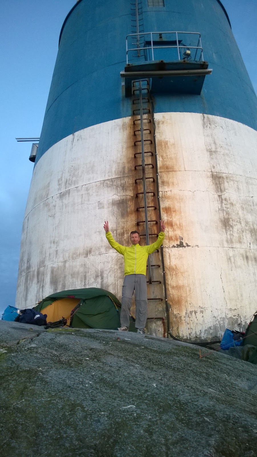
Finally at Bogskär!

The 64 km route to Bogskär lighthouse can be found from here. The next day 50 km open sea crossing back to Kökar archipelago can be found here and the last 18 km stretch back to Sandviken camping from here.

On 28th of June 2016 after 2 years planning and waiting suitable weather conditions I finally managed to paddle to the southernmost point of Finland, Bogskär lighthouse islet in the middle of Baltic Sea. Bogskär is surrounded by 40 km open sea and that makes it very hard to paddle safely. There are no shelter at all and constant wind makes the paddling demanding.

It was roughly 3 years ago, when I spoke to one of my paddling friend, Jarkko, and ask him to join me in order to paddle to Bogskär island and complete my lighthouse paddling project (altogether 74 lighthouses). We started planning two years back and recruited third man, Pertti, to join our expedition.

During the summer 2015 we were ready to paddle, but due to extremely windy weather conditions we were not able to find a decent period of time, when paddling could be safely done.

Quite suddenly after midsummer this year the weather forecast was showing a possible weather - window to accomplish 4 day and 130 km paddling trip.

We started to drive 3 kayaks on top of the car from Tampere on Monday morning 27th of June towards Korppoo and Galtby harbor, from where the ferry took us to Kökar archipelago. It was 6 PM, when we drove to Sandviken camping and started to pack our kayaks for the evening paddle towards outer small islets on the sea. The headwind was stronger than we expected and instead of planned 25 km paddling we managed to paddle only 7 km just to the next island, Ändör,  to the west from Kökar.

View towards Kökar archipelago from Ändör

The terns kept me awake whole night and I was already up at wake-up time 5:30. The wind was calmed during the night and after breakfast we headed towards south-west in a beautiful sunny weather. After three hours paddling we reached outermost islets with huge seal colony. There were hundreds of seals following our kayaks and looking our lunch break at Bredkläpp - islet.

Terns flying on a sunset on Ändör

The long 40 km crossing started at 11:20 and wind increased to 5 m/s and further gradually up to 8,5 m/s when we finally after 8 hours crossing reached Bogskär lighthouse island. The landing was demanding, but we managed to get ashore and I was extremely happy and tired. During the long evening we did some filming, had a dinner and pitched our tents next to lighthouse. There were not too many spots where to pitch a tent! We got a possibility to look at the couple of seals, who were sleeping on the rocks of Bogskär.

Coming to Bogskär lighthouse

The wind was calming again during the night and morning showed sunny and calm. Today we headed to North-East and we had a mild tailwind behind us. After 4 km paddling passed Bogskär - daymark island and started a long and exhausting crossing. Finally after 11 hours and 50 km paddling the crossing was over and we reached the southernmost archipelago of Kökar. I was relieved when crossings were  over and we had only 18 km paddling tomorrow to Sandviken camping through the archipelago.

Bogskär - daymark

On Thursday morning 30th of June at 7:30 we started our last leg and paddled on moderate tailwind to camping where we ended our 4 day trip.
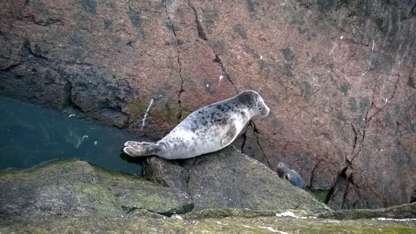
Seals on the rocks of Bogskär

Bogskär lighthouse island is now conquered by paddlers and at the same time all lighthouse islands have been visited by paddling!!!!!  I'm extremely happy it is over now and I can concentrate on other things from now on...

Back at Sandviken camping, trip is safely over!

Wednesday, August 26, 2015

Paddling through Archipelago National Park

Finland were cherished by warm weather and mild winds due to the strong and long lasting high pressure in Scandinavia. I had couple of objectives this year, which I hadn't succeeded to complete yet.

Therefore I decided to head to the Baltic Sea with my sea kayak and within two days paddle to Utö lighthouse island and back to mainland. It was going to be roughly 80-90 km paddling, but fortunately weather should be fine for such a tedious paddling trip.

Cause I had only two days off the work, I started driving from Tampere early on the Friday morning at 5:45 towards Korpoström guest harbor, from where I would be starting the paddling trip. I arrived to Korpoström well on a schedule after 9 AM and did quick packing of my kayak. Just after 10 AM I was ready to start to paddle through Archipelago National Park to Utö.

180 degrees at start and heading south

The wind was blowing 3-4 m/s from southwest and therefore I had headwind all the day. Because it was a early Friday morning there were not many boats on the waters. I saw only one sailing boat on my way to Ingolskär small islet, which were my first goal today. After 2,5 hours paddling I was on Ingolskär and found a decent landing spot for my kayak to get ashore. Ingolskär - daymark, which had been built on 1873, was standing on the highest spot on the islet. I decided to have lunch as well and stayed for awhile on the warm rocks enjoying the sunshine and the views.

Ingolskär - daymark

The next goal today was to visit on Lill Gråharu daymark islet just next to Utö lighthouse island. There were couple of long 10 km crossings before and after Vidskär - island. They went pretty well and I just needed to be cautious because there were lots of waterways crossing this area. I didn't see any cargo vessels though and felt quite safe.

Lunch at Ingolskär

At 6 PM I arrived to Lill Gråharu daymark islet and got ashore. Lill Gråharu daymark is even older than Ingolskär, it was built on 1856. On a slippery rocks I felt down, but fortunately got only couple of scratches to my arms and legs.

Lill Gråharu - daymark

There were only 3-4 km paddling to Utö and found a narrow ledge of flat rocks, where I pitched my tent. I was hungry after 8 hours paddling and had good supper watching lighthouse on a sunset.

Utö - lighthouse and sunset

The paddling route of Friday can be found from here.

The Saturday morning was beautiful and I had a good breakfast before starting paddling back to mainland. I was on the water at 8 AM and during the first crossing to Vidskär saw one big cargo vessel passing me by. The wind was pretty much non-existent or slight tailwind. There were more boats today than yesterday on the waters. Sun was shining and I was sweating and drinking lots of water during the paddling. Finally after 4 hours paddling I arrived to Brunskär and had a lunch on a warm rocks.

At Brunskär

On the way back to Korpoström I checked Stora Hästö landing spot and anchoring harbor. It seemed to be really nice place. Have to keep in mind for the next visits to this area.

Just before 4 PM I got back to Korpoström and had 4 hours drive back to Tampere. The trip was successful, I managed to visit two daymarks, which were on my list for this summer. I have only 1 lighthouse and 1 daymark to be visited by paddling, hopefully can complete my 10 year paddling project next year!

The paddling route of Saturday can be found from here.

Wednesday, July 8, 2015

Weekend paddling trip to Åland

Surprisingly weather forecast was promising sunny and warm days during the weekend and thus I decided to travel to Åland islands and paddle couple of days on the southern part of archipelago.

Åland

Jumped to the ferry at Turku harbor on Friday evening. At the same time there were Ruisrock - festivals on Ruissalo - island just next to harbor. Thousands of people partying at the festival saw the ferry passing by the festival area. It was blowing strongly, but the forecast promised winds would calm down for Saturday and Sunday.

The ferry arrived to Långnäs harbor on Åland at 1 AM after which had a short drive to Västeränga for staying overnight before the paddling. Saturday morning showed off sunny and after packing stuff to kayak was ready to start paddling towards Kobbaklintar roughly 13 km away.

Marhällan daymark and the ferry

Visited Marhällan and Kobbaklintar - daymarks at the time when there was bunch of ferries passing by. Spent many hours on Kobbklintar - island enjoying the views and visiting idyllic cafe.

On a Kobbaklintar

The paddling continued towards Ledskär - daymark via Rödhamn guest harbor. Took pieces of smoked salmon from Rödhamn and paddled 4 more km to Ledskär. It was a bit difficult to find a landing spot, but finally found a rock, where could get ashore and have a short break. It was evening already and Ledskär didn't seem to be a good place for tenting so decided to paddle still further. Found a beautiful rocks on Norra Askskär. Paddling route for Saturday can be seen from here.

Reflection on the way to Fästorna

It was raining during the night, but the Sunday morning turned out clear and sunny. The goal for today was to reach Fästorna - daymark 15 km away on a tiny islet in the middle of the sea. Fortunately there were no winds at all and paddling went easily. After 2,5 hours paddling Fästorna was there and because of the calm waters landing was possible to this small islet.

Landing spot at Fästorna

The way back to Västeränga took some 4 hours. Route for Sunday is visible here. All in all paddling distance for these two days were 75 km and visited 4 new daymarks too. Just superb weekend on the sunny Baltic Sea !

Friday, June 26, 2015

Russarö

I have been trying to visit Russarö - lighthouse island close to Hanko many years, but haven't had the permit to visit the island. The island is still military area and you'll need a permit from defence forces to get ashore.

I had already the permit for visit years back, but I was unlucky, cause at that day there were a storm with winds blowing up to 17-20 m/s and I couldn't kayak to the island.

Landing spot at Russarö

Now I managed to get a permit and weather forecast seemed to be very good for kayaking as well. The island is not far away from the harbor and the paddling distance to the island is a bit over 5 km. The sun was shining when started paddling from the guest harbor and crossed the waterway, which is used by huge cargo vessels coming to and leaving from Hanko harbor.

In the northern tip of the island there were sheltered lagoon, from where getting ashore was easy and possible. The lighthouse itself is located on the southern cliffs and the road leading to the lighthouse was a bit muddy, cause there had been lots of rain in previous days.

Russarö - lighthouse

Russarö was my 36th lighthouse. Not too many left anymore...

Thursday, June 25, 2015

Kayaking trips during midsummer

During the last years I have been heading onto Baltic Sea during midsummer for kayaking trips. This midsummer was not an exception. The weather forecast was looking pretty ok, mild winds but occasional showers.

Start at 23:00

On midsummer eve, Friday 19.6, drove to Dragsfjärd, packed the kayak and started paddling at 23:00. Short paddling to Högland - island just 5 km away. On the northern tip of the island there is a tenting area with a small sand beach. Just after midnight arrived and put the tent under the tree on the grass. Birds were loud during the night and couldn't sleep too well. Route of Friday paddling can be seen here.

At Högland

After breakfast at 8:00 headed towards Spelharu - daymark island some 10 km away. The paddling was easy on a light tailwind. Spelharu - was my 30th daymark to be visited by kayak. It would need urgently some fixing and maintenance...

Spelharu

After Spelharu returned back to car. All in all 30 km paddling and the route for Saturday morning can be seen from here.

It was lunch time and stomach was yelling some food, so decided to stop over nearby at Kasnäs and eat a decent lunch (more or less brunch). It was absolutely delicious. The main objective though for this midsummer was still ahead. I had a plan to visit at Haapasaari roughly 25 km south of Kotka. Drove to Kotka in a heavy rain and thought if the rain would continue as well in Kotka, but luckily when arriving to harbor there were not anymore any raindrops.

Unpacked the car and packed the kayak and was ready to start paddling at 20:00. The evening was nice with sunshine and non-existent wind. First 10 km paddling was beautiful but when had to cross waterways, which were used by the big cargo vessels coming to and leaving from Kotka harbor dense fog just arrived. Visibility was just few hundreds meters and I felt unpleasant when paddling in silence and couldn't see anything. The navigation was extremely difficult and found finally Haapasaari island at 24:00 because of my GPS-equipment. It was a spooky feeling when arriving from the fog to island in a darkness.

Arriving Haapasaari at 24:00

Pitched the tent next to daymark on a rock and slept well after a long and tired day. The paddling distance of Saturday evening was 25 km and the route can be found from here.

Haapasaari - daymark

The next day, Sunday 21.6 was luckily bright with sunshine and the return trip back to Kotka was much more pleasant when visibility was good. Route back to Kotka was more or less the same as yesterday's paddling. Route is here.

Haapasaari - daymark was 31st and total paddling distance during midsummer 81 km.

Wednesday, March 18, 2015

Worldloppet Master nr 4015

Worldloppet - medal

Gatineau-loppet, American Birkebeiner and Vasaloppet were my last 3 Worldloppet ski races.

I was happily surprised when only 10 days after Vasaloppet I got an envelope, which included diploma and a medal for successfully completing Worldloppet. It was 4015th time since it's beginning.

Based on my subjective opinion and experience from the different Worldloppet events I composed a comparison of different Worldloppet ski races. Part of this comparison has been published earlier on my previous postings (Feb 24th, 2013).

BirkebeinerrennetDolomitenlaufMarcialongaKönig Ludwig Lauf
Distance54 km CL42 km CL70 km CL50 km CL*
When (week)11345
Total ascent (m)1010745757272*
StartRenaObertilliachMoenaEttal
FinishLillehammerObertilliachCanazeiOberammergau
Track condition101091*
Route10898*
Fluency (no jam at track)8867
Washing facilities964-
Transportation--99
CommentsScenic route over the mountains. Physically tough.At high altitude. Steep and long climbs.Through tiny villages at Val di Fiemme valley.*Due to exceptionally warm weather and lack of snow, route was shortened to 42 km.
TipsStart slowly, demanding climb at the beginning.Travel 2-3 days before to acclimatize to higher altitude.The start place is crucial. Lots of waiting and standing in queues if start place is in the last groups.Original 50 km route would have been more scenic.


La TransjurassienneTartu maratonFinlandiahiihto
Distance50 km CL63 km CL50 km CL
When (week)678
Total ascent (m)648695527
StartLes RoussesOtepääLahti
FinishMoutheElvaLahti
Track condition1010+5
Route10106
Fluency (no jam at track)897
Washing facilities8-9
Transportation58-
CommentsVery scenic route. Lots of snow.Well organised. Easy and good route. Tracks in excellent condition.Overpriced. Tracks always in poor condition.
TipsRent a car from Geneva airport, don't take transportation from the organiser. Get accommodation from Mouthe.Tampere maja accommodation in center of Tartu is excellent. Buses to start leave very close.Never again…


GatineauAmerican BirkebeinerVasaloppet
Distance51 km CL55 km CL90 km CL
When (week)7810
Total ascent (m)891819805
StartWakefieldTelemarkSälen
FinishMont Bleu in GatineauHaywardMora
Track condition671
Route10108
Fluency (no jam at track)791
Washing facilities00 (paid only in separate location)3
Transportation77 (too early bus drive to start)8
CommentsNear Ottawa. Route in beautiful Gatineau - park. Can be very cold.Can be very cold. Lot's of short and steep up and downs.Too crowded, no medals, overvalued, expensive
TipsStay couple of extra days and see Ottawa area.Fly to Minneapolis and rent car from there. 3 hours drive to Hayward.Choose open track instead of main race


As requested I added similar comparison table from three well-known ski events in Finland...

PirkanhiihtoPogostan hiihtoVuokattihiihto
Distance90 km CL51 km CL60 km CL
When (week)91112
Total ascent (m)749447777
StartNiinisaloIlomantsiVuokatti
FinishTampereIlomantsiVuokatti
Track condition889
Route789
Fluency (no jam at track)899
Washing facilities-99
Transportation9--
CommentsEarly start at 7 AM. Typically dark and cold at the beginning.Hospitality and nice atmosphere. Beautiful route in wilderness up to Petkeljärvi national park.Scenic climb to Vuokattivaara.
Tips

Monday, March 9, 2015

Vasaloppet successfully completed

Ready to start at Sälen

On Sunday morning I started on 90 km ski event at Sälen, Sweden. It was going to be tough and long day. Day temperature were forecasted to be around 9 degrees and therefore the skiing conditions were extremely wet and tough.

At the very beginning I realized my skis didn't glide at all and immediately I knew this is going to be tough. First 4 km uphill were pretty much standing on the queue, cause 14 000 skiers were on the track at the same time. It was frustrating to fight with the poles and skis your way to the top of the hill.

There were no tracks anymore and lots of water some places, even ice. Skiing conditions were poor or should I say just horrible. I have never skied on this type of conditions before and now it was 90 km to go...

Finish line at Mora

When I arrived to the finish line I was exhausted and extremely satisfied, this was my 10th Worldloppet skiing race, now I have done it. No more skiing anymore this year...